
Contrary to popular belief, the island nation known as Singapore is not one island, but comprised of more than 60 islands at one point in time. Though most of the islanders are familiar with the names of these islands and its history, many from the rest of the mainland may have heard them for the very first time.
Pulau Bukom, or Bukum, is situated 6.5 km southwest of Singapore and housed Singapore’s first petroleum tank depot and oil refinery. It’s been said that Bukom is named after a seashell species, the rankek bukom. Once the oil supply centre for the Far East, this 1.45 square km island was the target of the Bukom Bombers who blew up an oil refinery in 1974. Today, Bukom is the site of Shell’s oil refinery and plants for the manufacture of chemicals. It also has a residential neighbourhood similar to a traditional Dutch town complete with various facilities.
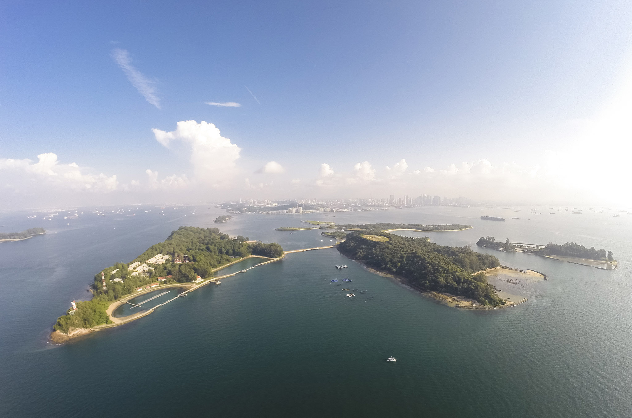
St. John’s Island, or Pulau Sekijang Bendera (Deer Flag Island in Malay), is a popular destination for its holiday bungalows. Located 6.5 km south of Singapore, this 39-hectare island was Raffles’s anchorage site before heading to Singapore in 1819. By the 1930s, it was recognised as a quarantine station for infectious diseases, then as a holding place for political prisoners and secret societies ringleaders. Today, its eastern end will house a Prison Detention Centre for illegal immigrants and drug addicts while the western end features the Tropical Marine Science Institute and Marine Aquaculture Centre.
Lazarus Island has all the makings of a picturesque island getaway. Unspoiled, with slightly more than a bit of jungle and a pristine, sweeping beach, it is tucked quietly between St. John’s and Kusu islands. Previously known as Pulau Sekijang Pelepah, which means Island of One Barking Deer and Palms in Malay, the island is almost entirely undeveloped and is connected to St. John’s via a paved bridge. Reclamation works have combined its northern part to Pulau Seringat, making the total area approximately 47 hectares.
Pulau Seringat, located south of Sentosa, underwent reclamation works in 2000 as part of the Singapore Tourism Board’s plan to develop the other southern islands. The reclamation, linking Seringat and Lazarus islands, created a sand bank and thus formed a lagoon with an unobstructed seaview. The island, now part of the extended Lazarus Island, features an 800-metre stretch of beach. Thousands of cubic metres of sand were imported to build the crescent-shaped beach, plus 1,000 mature coconut trees were planted to add to the island feel.

Pulau Sudong is a 209-hectare coral island southwest of Singapore and one of the last Southern islands to host an original living population in a kampong. Sudong, said to derive from tudong or ‘a cover’ was named so because the island’s shape with the reef around it resembled the common food cover. Initially intended as a recreational island, Sudong is now reserved exclusively for military training and live-firing exercises together with Pulau Pawai and Pulau Senang after reclamation work in the late 1970s enlarged its size by 12.5 times.

Pulau Blakang Mati, the largest of Singapore’s southern islands at almost five square km, served as an island fortress and a military base in colonial times. The island’s name came about after legend had it that a Malay had been murdered behind the hill. It was also thought to be a reference to the piracy and bloodshed that once took over the island. Today, the island is known as Sentosa or Isle of Tranquility, and is a huge amusement park that attracts locals and tourists alike through its own causeway, ferry connections and by cable car.

Pulau Brani or Isle of the Brave is situated on Singapore’s southern coast near Keppel Harbour. Brani got its name from a well at the top of the hill with water that supposedly had potent qualities. The island has seen many changes to its landscape; from Malay fishing villages along the coast to a navy and military fort, it was also home to the Straits Trading Company’s tin smelting plant. Today, over half of Brani features a container terminal and other port facilities, and a causeway connects it with the mainland for smoother harbour operations.

Pulau Senang or Isle of Ease had its beginnings as no more than a rock covered with trees and scrubs in the China Sea with relatively fertile soil and several fresh water wells. Situated 15 miles south of Singapore, the island is most famous as a penal reform experiment in 1960 that failed when a riot broke out three years later which resulted in the deaths of Prison Officer Daniel Stanley Dutton and three of his assistants. Together with Pulau Pawai and Pulau Sudong, today it is used as a military training area for live-fire exercises.

Pulau Semakau, the world’s first ecological offshore landfill, is located 8 km south of Singapore and covers an area of about 70 hectares. Origins of its name remains a mystery although semak means scrub or undergrowth in Malay. Once home to a small fishing village, Semakau was turned into a landfill in 1999 by enclosing the waters between its eastern part and the western part of Pulau Sakeng (Seking) to create a rock embankment. Unlike other landfills, Semakau is clean and free of odours thanks to a more efficient waste process system.

What started out as two outcrops on a reef, Kusu Island is now transformed into an 8.5-hectare holiday resort. It is located 5.6 km southwest of Singapore and attracts thousands of pilgrims annually. Legend had it a magical tortoise turned itself into an island to save two shipwrecked sailors, a Malay and a Chinese, hence the name kusu which means tortoise or turtle in Chinese. Devotees flock here during the ninth lunar month for the annual Kusu Pilgrimage in the hope of securing good health, peace, happiness, good luck and prosperity.
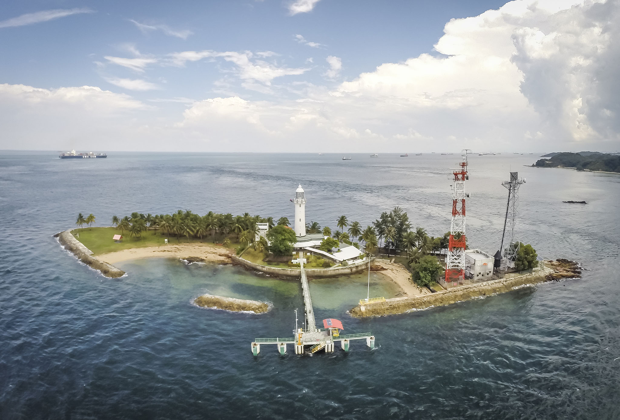
Singapore’s southernmost island, Pulau Satumu, lies 23 km southwest of the mainland. Loosely translated as One Tree Island, this 1.3-hectare rocky island is home to the Raffles Lighthouse, named after the founder of modern Singapore Sir Stamford Raffles. Lit since 1855, the lighthouse serves to warn ships from sailing too close to shore or shallow waters. Only the Raffles Lighthouse staff and visitors with special permission are allowed on the island. Thanks to its distance from the main island, the waters here are less disturbed and has resulted in a rich reef habitat.